TERRASCOUT
Offline Outdoor Navigation
An offline-first navigation co-pilot for the backcountry, built for Apple Silicon Macs. Live GPS, topographic maps, 4x4 dirt-trail routing, and hunt, camp & fish intelligence — all running on your machine, with zero signal required once the maps are downloaded.
The places worth going are the places without bars on the phone. Forest-service two-tracks, dispersed campsites, hunt units miles from the nearest tower, dirt climbs to a peak at last light. That’s exactly where every cloud-tethered nav app quietly stops working.
TerraScout is built for the dashboard of a Sprinter van, not a data center. Set the laptop beside the driver and it becomes a glanceable journey co-pilot: where you are, how fast, what’s under you, whose land it is, and how far to camp — fed by a GPS module and a fully offline map. Download the states you’re crossing once; after that it’s just you, the terrain, and the trail.
Live GPS & Co-Pilot HUD
Follow your position from an external NMEA GPS receiver or this device. A glanceable drive-mode strip shows speed, heading, elevation, land owner, hunt unit, and distance to your destination.
Offline Topographic Maps
The full basemap and terrain live on disk. Pan, zoom, search, and navigate with no signal once a region is downloaded — the map never falls off a cliff at the edge of coverage.
4x4 Dirt-Trail Routing
Turn-by-turn road routing that keeps drivable dirt and forest roads by default — for the trails near Mammoth Creek to the top of Brian Head — with a one-tap “paved only” toggle for the highway.
Seamless Cross-State Trips
As you approach a state line, TerraScout offers a one-tap download of that state’s maps and routing. Adjacent states merge into one graph, so directions route cleanly across the border.
Hunt, Camp & Fish Data
Game-management units, species ranges, public-land ownership, campgrounds, and lake bathymetry — layered onto the map and stored offline for the states you’ve installed.
Weather & Solunar
Local forecasts plus solunar and sun/moon tables for planning the day around first light and game movement — cached so they’re there when the connection isn’t.
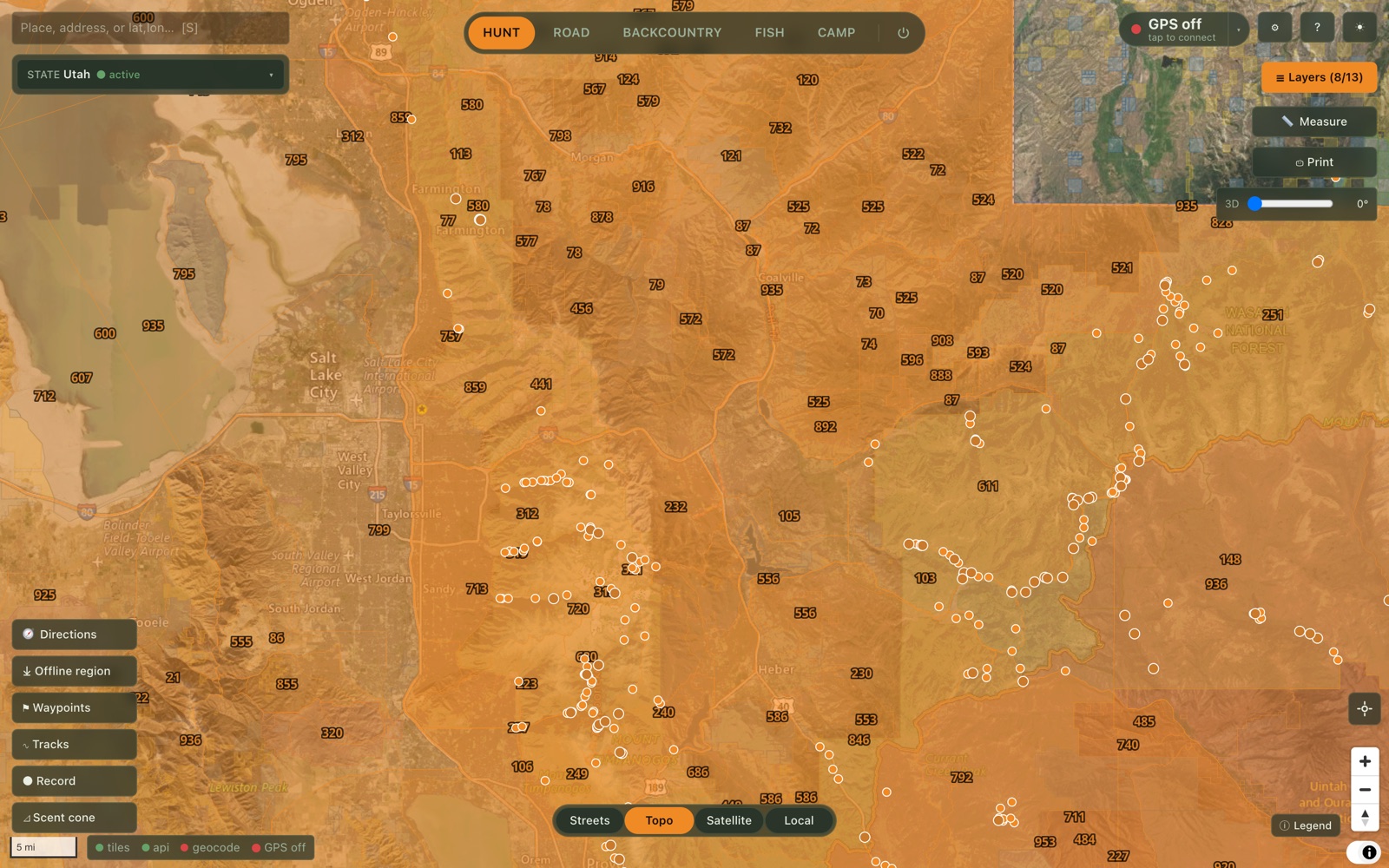
Hunt mode · offline topo
Game-management units labeled statewide over a fully offline USGS topographic basemap, with the vertical switcher, live coordinate readout, and tool rail.
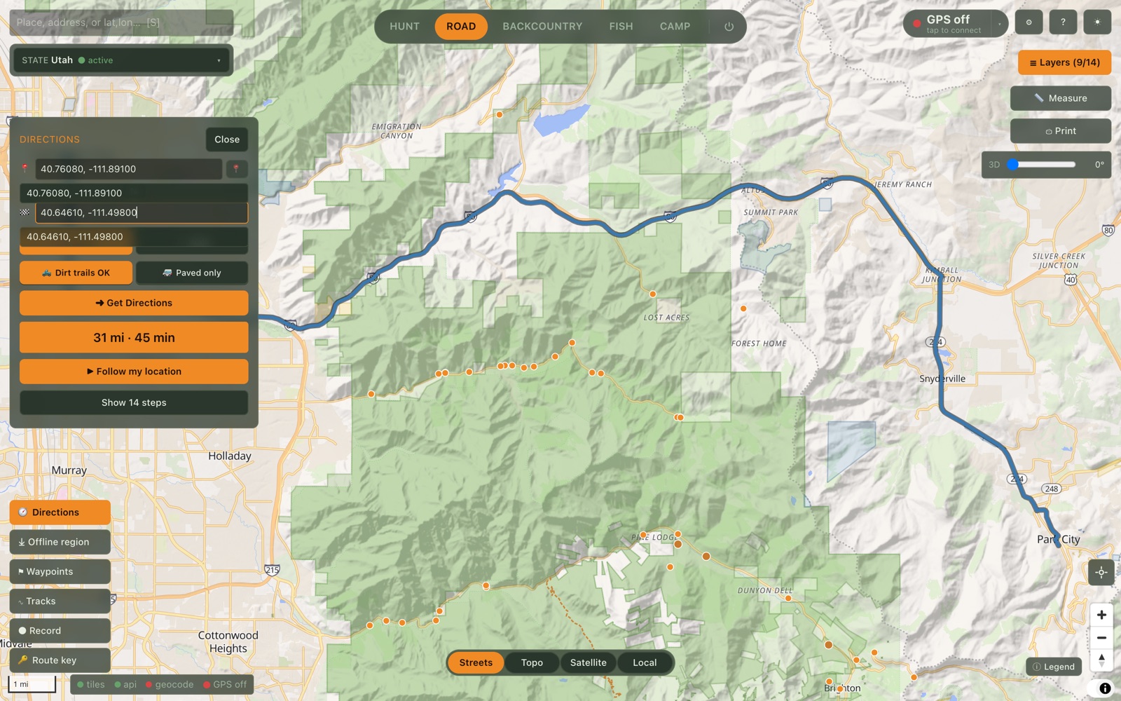
4x4 routing
Drive or walk, with a one-tap “Dirt trails OK” vs. “Paved only” toggle for the van.
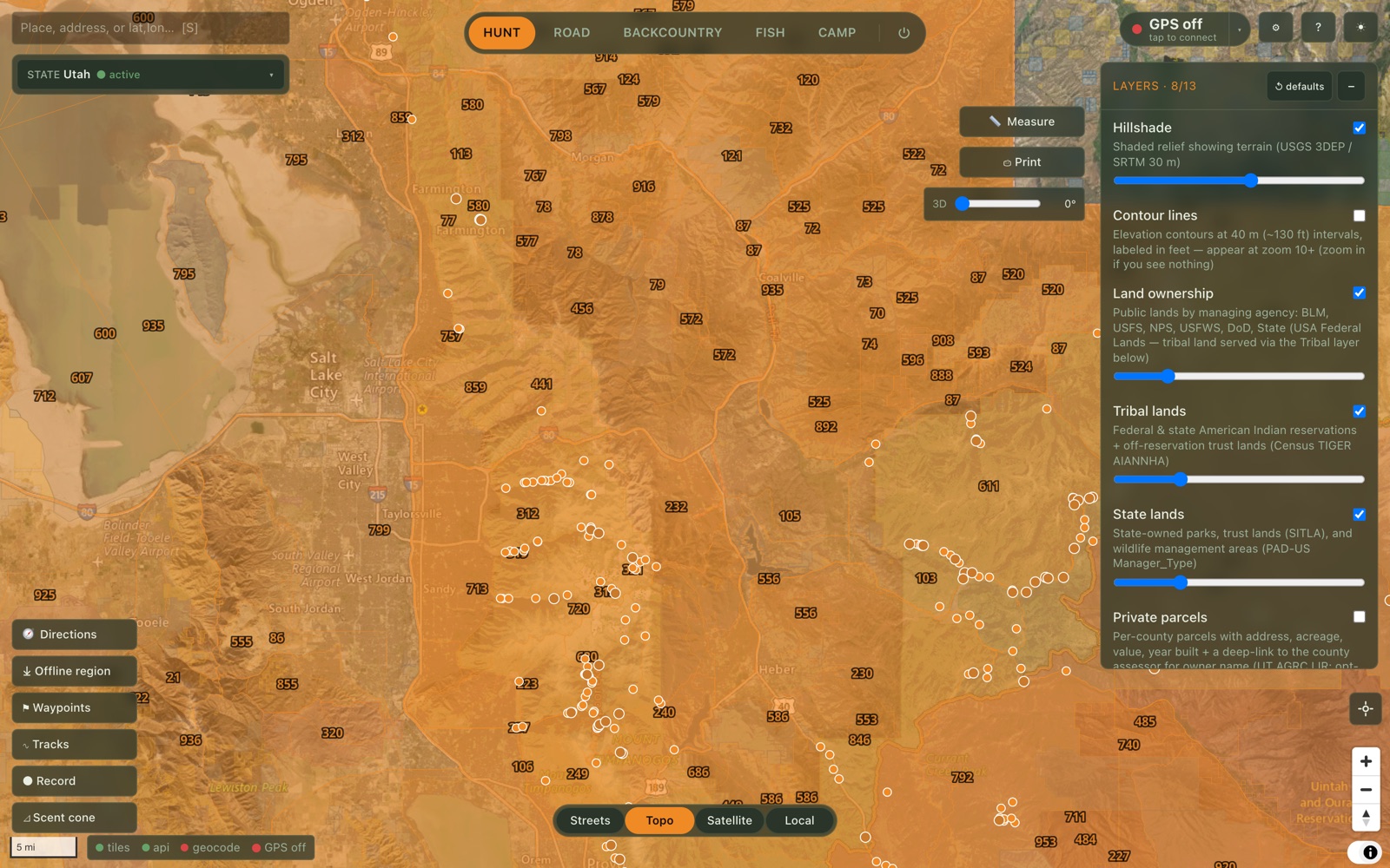
Offline overlays
Hillshade, contours, public-land ownership, tribal & state lands, and parcels — all local.
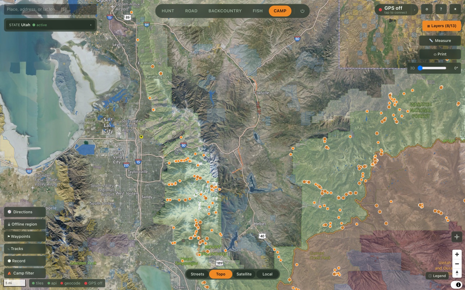
Camp mode · public land & campgrounds
Satellite imagery blended with color-coded public-land ownership (BLM, USFS, tribal, state) and campground markers, so you always know whose land you’re on.
TerraScout reshapes around what you’re doing. Camping surfaces campgrounds and dispersed sites; Hunting overlays game-management units, species ranges, and land ownership; Fishing adds lake bathymetry; Off-road leans into the dirt-trail network; and Backcountry brings elevation, terrain, and route planning to the foreground.
Every feature is built to abstract across all fifty states — nothing is hard-wired to one place. Download Utah for the canyons, add Colorado and Wyoming for the drive north, and the whole map, routing, and data set comes with you.
v0.8.0 · Apple Silicon · Signed & Notarized
Requires a Mac with Apple Silicon (M1 or later) running macOS 12+. Open the DMG and drag TerraScout into your Applications folder. On first launch, choose the states you want and let their maps and routing download — after that, the app runs entirely offline.